Moby-Dick Project

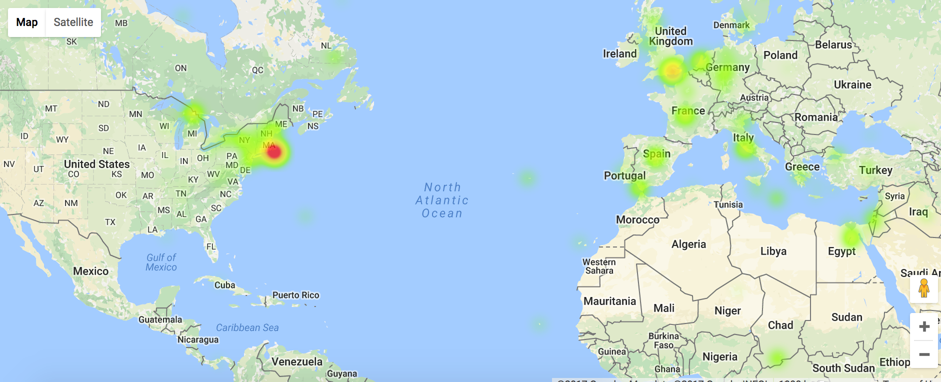
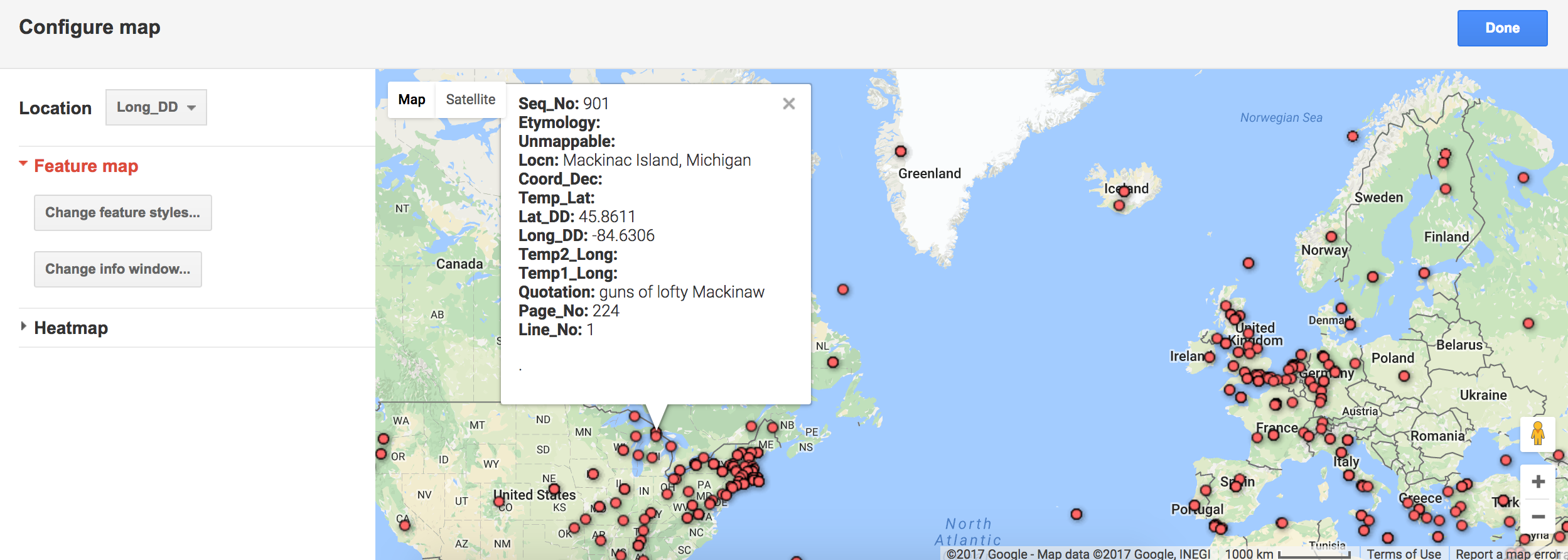
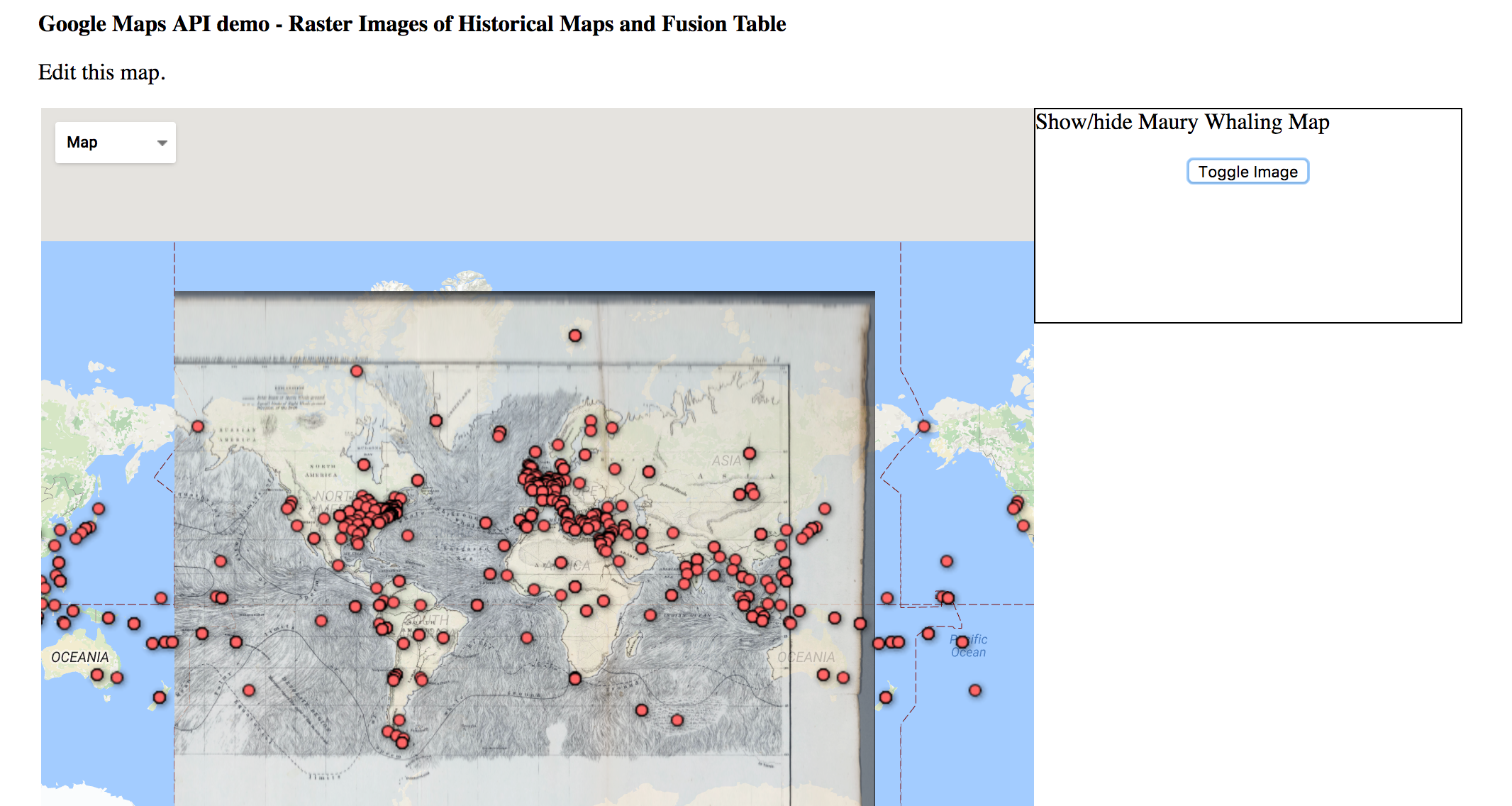
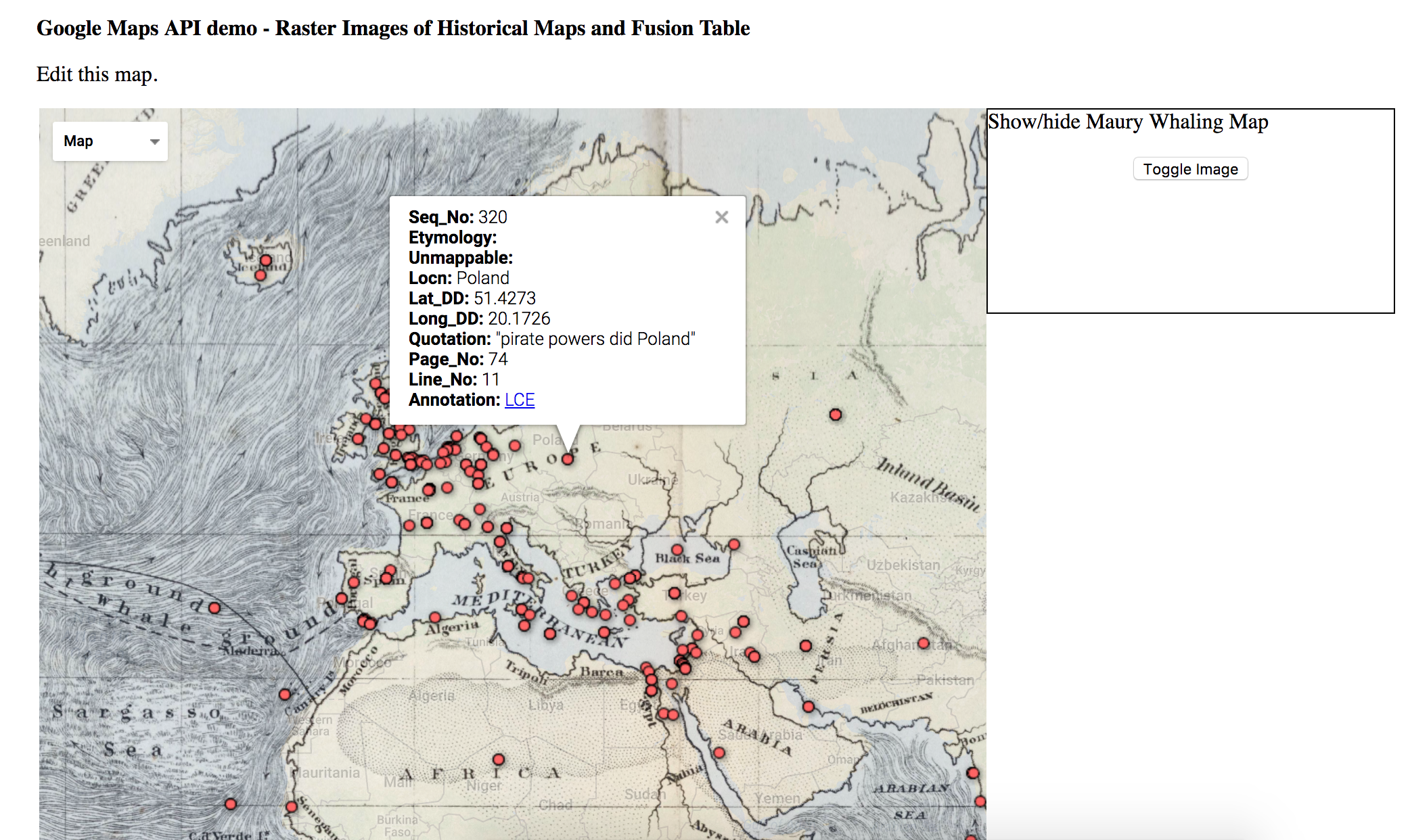
For this project, I got to use Google Fusion Tables and work with location data extracted from Melville’s novel “Moby-Dick”. I personally thought the data was easy to work with and abGoogle Fusion Tables made for a nice and organized way to display all of the data. It was also really helpful that there was a guideline on how to use import the data into Google Fusion Tables. In the end, once everything was set up, I could play around with the parameters and with the map to look at the different locations and information from the book. I really liked how it was all presented in a map and how all I had to do was click on the various points on the map and detailed information about that one speficic location would pop up or I could look at the heat map and play around with the radius. I could even play around with another file that had the “Maury Whaling Map” overlay the original world map.
Potential limitations would be the fact that the everytime I choose a new point on the map, the detailed information of the old point goes away. It would be useful if it would stay open unless I exit it myself that way if I wanted to compare two locations for some reason then I would not have to be swiching back and forth to see the information. Also I think it would be cool to have a list with all of the locations on the side, somewhat like a side bar menu, where the user can simply click on a location from there and on the map the detailed information at that specific location would pop up.