Hidden Charles – A location-based AR app
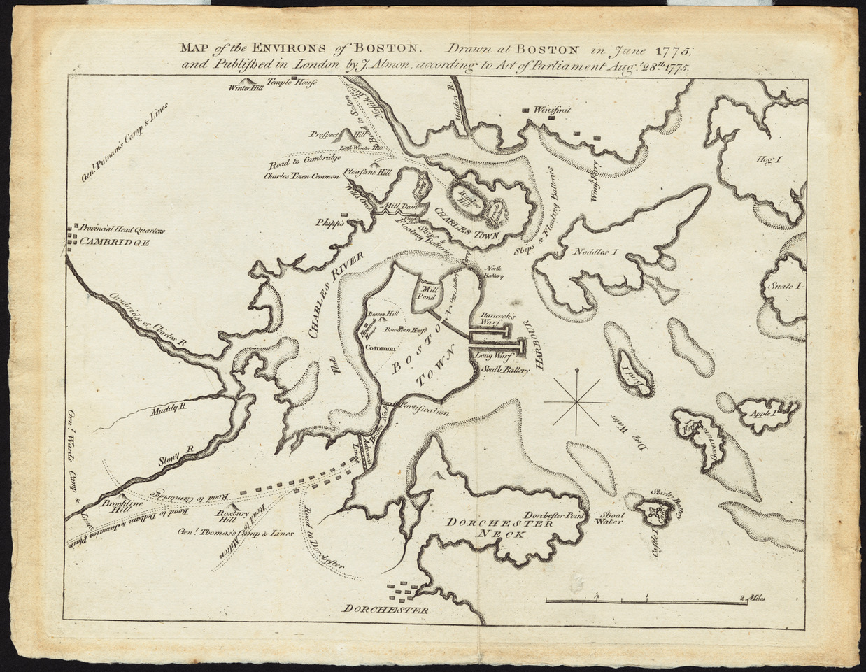
In the 1600s, Boston consisted mostly of small islands and the Charles River emptied into a wide delta. As this map of 1775 shows, most areas that we walk on today were either water or swamp land. I later centuries, more and more swamp and water areas were filled in and built upon. The MIT campus that we know today only became a landfill in the early 20th century. For most people the former topography of Cambridge and Boston is hardly known and largely hidden. What if we could create a location-aware mobile app that could alert us every time we cross the former border of the Charles or stepped into the water form one of the former islands of Boston? Settings for different centuries would bring about different alerts, historical maps could be pulled up, overlaid with a contemporary map, historical photos, and other relevant documents could be available to provide historical depth to the Cambridge and Boston neighborhoods. An app for tourists and residents alike with the option of leaving comments, stories, and notes tied to a location. And maybe, the app could look into the future as well, when the sea levels have risen due to global warming and parts of Boston and Cambridge will be under water again …
The public libraries in Boston and Cambridge have countless old maps and other documents and mobile AR apps are available as well.
Maybe a project for those interested in history, maps, location-based apps, etc.