Moby Dick Mapping Exercise
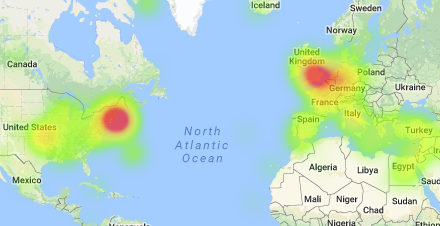
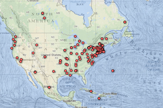
I thought while Fusion Tables was definitely still in beta and could use some improvements on the UI, it was an interesting exercise seeing what it could do in tandem with the Google Maps API. In Fusion Tables itself, I immediately gravitated towards the filtering tool. I used this to explore some of the text and how accurately the locations were. I also used this to quickly examine the points in the text that were labelled “unmappable”. After this, I explored the heat map. Like I expected, most of the points centered around the United Kingdom and the New England areas. This was really only detectable on the heatmap, as points definitely look a lot more dispersed on the feature map.
In conjunction with the Google Maps API, I could definitely see even more capabilities to uncover. The GMaps API is quite mature and is used in millions of applications, so I know it would work well. However, I did experience some lag with implementing the Fusion Layer and the overlay. Wasn’t sure if it was my computer. I thought it was interesting to look at the various location names on the old map, and how they possibly correlate to the various points. In general, when playing with the fusion layer and the map overlay, I thought of Bodenhamer’s text, and the concept of “deep maps”. I definitely this use of layering over a standard map is a initial implementation of some of the layers of a deep map. A future extension of this exercise might be combining the map with the actual text, allowing the user to click on the text and zoom into the exact spot of the book, providing more context around the quotations.