Erick's Assignment 4
Mini Project
I used Fusion Tables since I’ve worked with CartoDB before, and here’s what I made!
Tooltips
First, I added a simple tooltip that displays a table of information, as guided by the instructions.

Next, I overlayed an image (with sli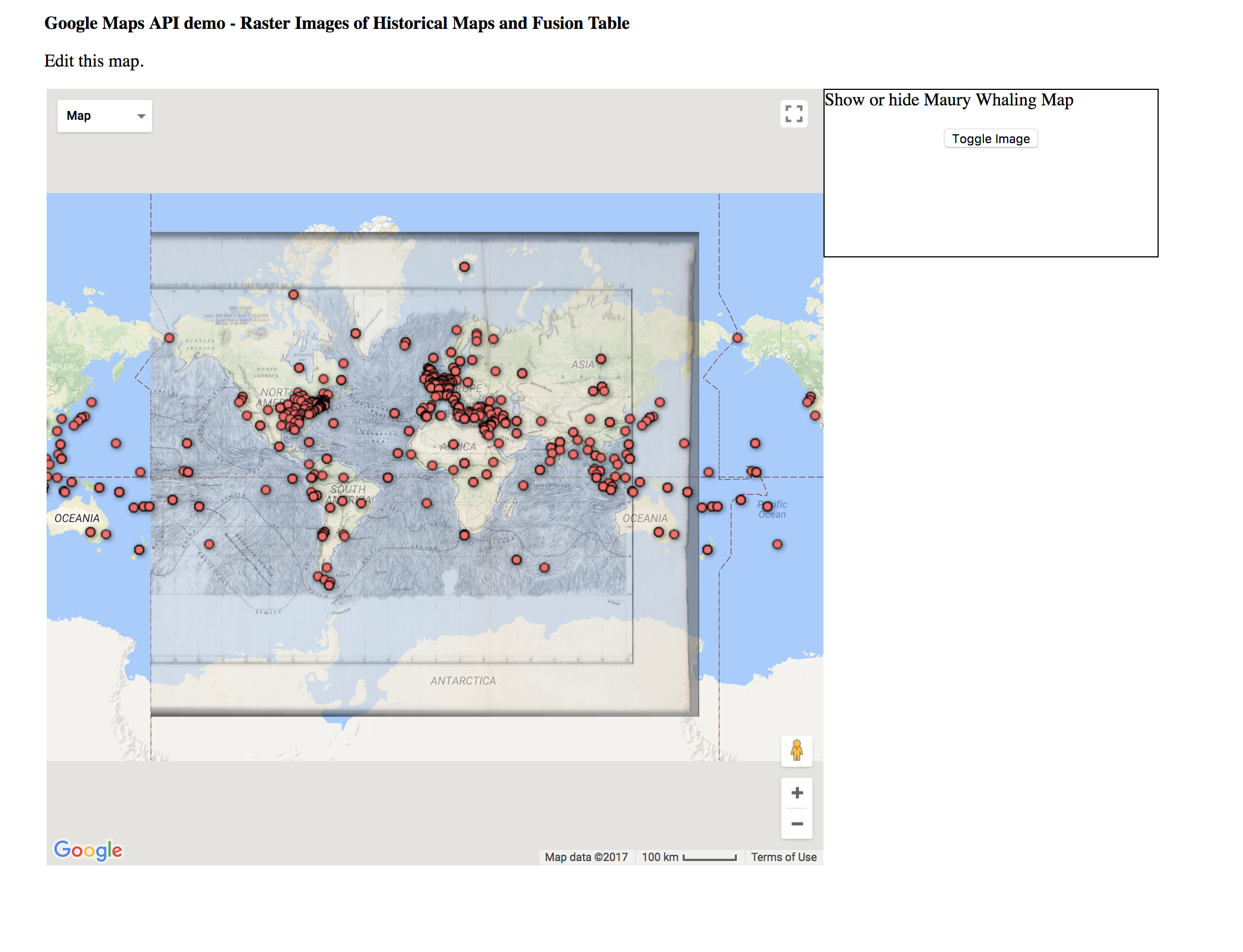 ghtly lower opacity than instructed), to show the datapoints in line with the old map!
While FusionTables is nice and easy to use, other mapping tools such as Carto are more modern and flexible. In particular, they take a more database-centric approach rather than focusing on CSV files or spreadsheets.