Spatial + Temporal Representation
Cartographies of Time, Rosenberg & Grafton
 Marey, Muybridge, and Douglas
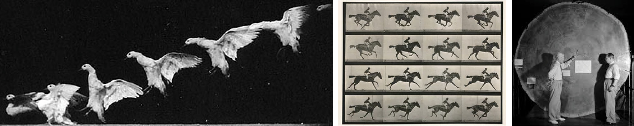
Photography, and more specifically, chronophotography, is examined by Rosenberg and Grafton as an instance of technology-enabled temporal representation. They point to three people who have used photography extensively in their work as a mode of representation, although their work has all been somewhat divergent. They point at Etienne-Jules Marey, Edward Muybridge, and Andrew Ellicott Douglas, and how temporal representation is a key issue in their work.
The idea of accurately depicting historical events, with context, temporal, and spatial axes is a difficult and informal; to further complicate this, objectivity is difficult to obtain. These three examples presented in the text show the impact of technology on representational and visual problems. There are three approaches in the work of Marey, Muybridge, and Douglas: an overlayed image, individual slides, and ironically, a static photo that also shows the greatest lapse of time.
Here, the three are addressing the representation of visual, bodily, and time-dependent data. In a simple, yet very understandable way, they have captured and shown how a bird flies, how a horse moves, and the aging of a tree. They reveal information that we wouldn’t have known, seen, or understood otherwise. Muybridge + Marey’s examination of bodily movements reveals, for example, ways the human and animal body contort in ways that are unexpected. The age of the tree, is almost the opposite of their work because it shows a “low speed” progression of time.
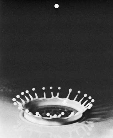
Doc Edgerton, from MIT
These examples show interesting ways in which technology can affect how we represent events. In the beginnings of photography, it was a very objective method of recording data that did not discriminate in what was recorded, as long as it was in front of the camera lens. This leads to work like Doc Edgerton’s, which did similar studies but on also inanimate objects and physical phenomena.
The Potential of Spatial Humanities, Bodenhamer
Shortcomings and Potentials of GIS
“GIS promises to re-invigorate our description of the world through its manipulation and visualization of vast quantities of data by means previously beyond the reach of most scholars… we again run the risk of portraying the world uncritically, this time with a veneer of legitimacy that is more difficult to detect or penetrate.”
GIS is a powerful tool that allows visualization of space and geography, but as with all technology and the extraction and resulting representation of data, I am interested in how GIS fails (in the eyes of Drucker) to sufficiently tell the story. Technology has a tendency to erase less priveleged points of view, and this idea is expressed in the text, as well.
With the politicalness of geography and maps, representing the data from more than one (i.e. Western) point of view is important. However, the existing implementations and uses of GIS are clearly useful, especially in urban planning, architecture, and the sciences.